LMS-Z420i – Terrestrial Laser Scanning
RIEGL terrestrial laser scanners provide detailed and highly accurate 3D data rapidly and efficiently. Applications are wide ranging, including Topography, Mining, As-Built Surveying, Architecture, Archaeology, Monitoring, Civil Engineering and City Modeling. It is rugged and fully portable instrument, tested under strict conditions for a reliable performance even under highly demanding environmental conditions.
PERFORMANCE
Acquisition of 3D data is done in a detailed and efficient way, plus with an accuracy of up to 10mm in static mode and up to 2 cm in the mobile mode. Measuring range is from 2 m to 1000 m. The vertical scanning is done on an angle adjustable up to 80 degrees, while on a horizontal angle adjustable up to 360 degrees, and the measurement is to 11,000 points per second.
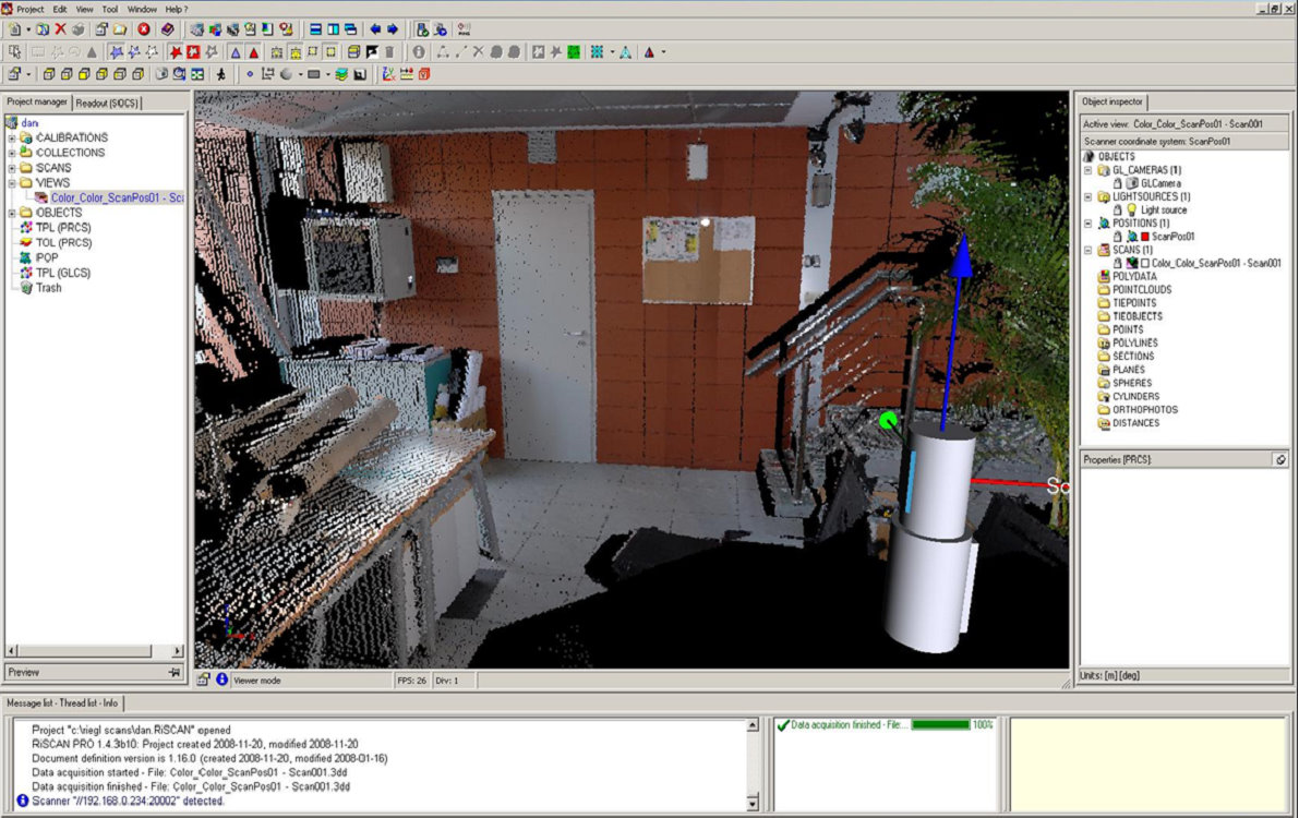
Scanned Data represents the amplitudes, strokes, angles and distances, all transmitted to a terminal through an Ethernet interface TCP / IP. Nikon D200 camera with a performance of 10.2 megapixel resolution of 3872 x 2592 pixels and lenses 14/50/85 mm, is mounted above the scanner with a very important role, namely to capture the image during the scanning, in which data are also transferred on the same terminal with a connection type USB / Firewire. The data stored in the terminal is processed with Riscan Pro. It is a software that allows a multitude of operations:
* Data acquisition;visualisation, handling and archiving them.
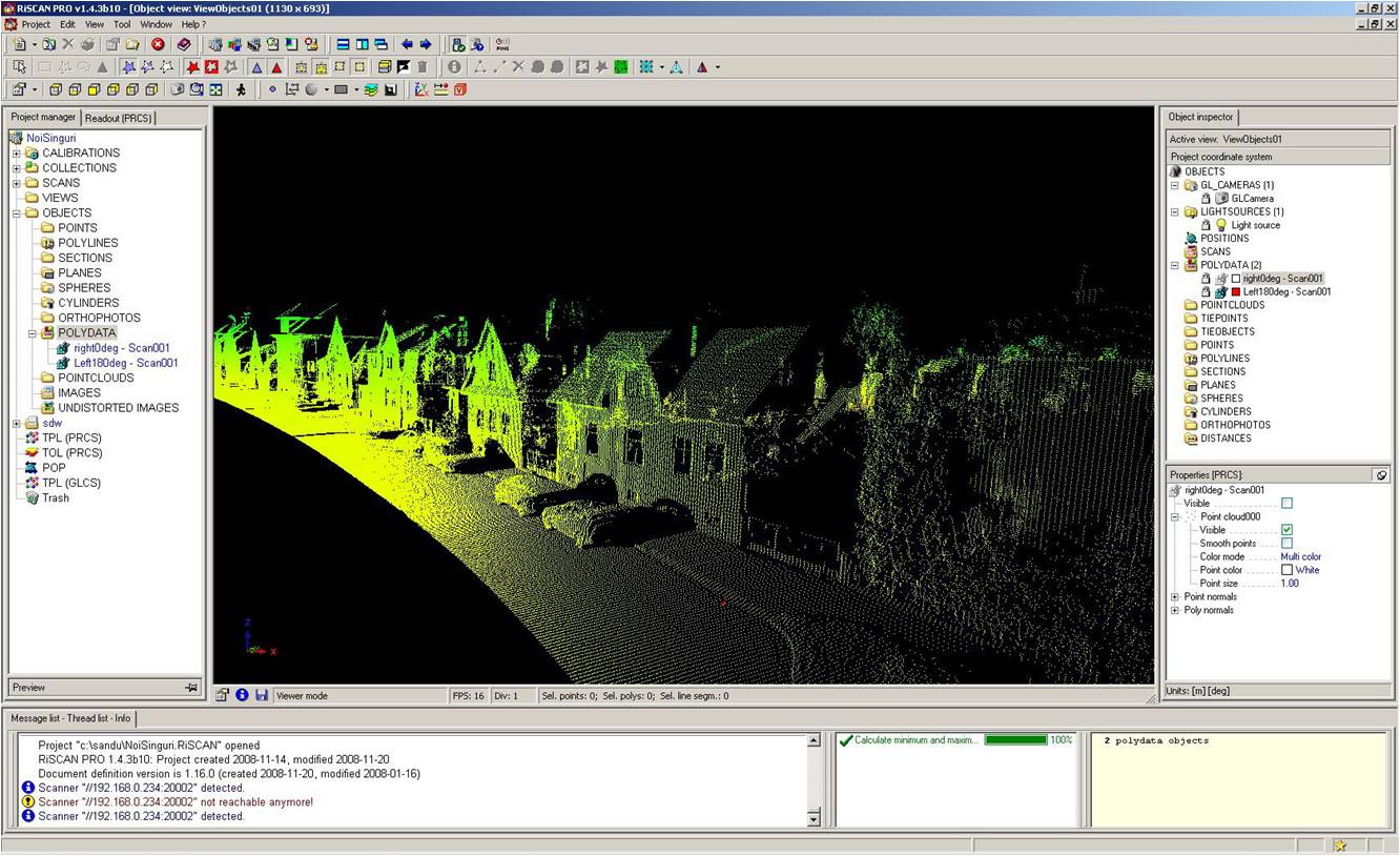
The system offers processing by automatic or manual data scanning and imaging products that can generate:
triangulate textures;areas,ortophotos with a certain depth of information and in combination with software and attached camera can generate :
* automated generation of high resolution textured meshes;
* photo realistic 3D reconstruction;
* identify the exact details;
* generation of 3D ortophotos;
* online distance and position of measurements;
* online settings of any virtual point of view.
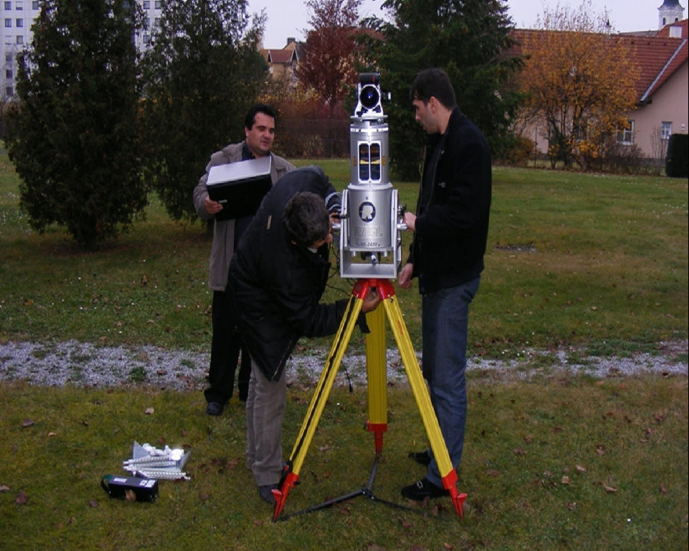
STATIC SCANNING
Scanning, 3D modeling by using 5 reflectors with inside diameter of 50 mm each as a bridge safety for pictures referencing made by the Nikon D200 camera overlaid on the 3D with a density of about 150,000 points made by the Z420i laser scanner and processed with software Riscan PRO
Land based mobile mapping and positioning provides an increase in productivity over traditional static methods in many market verticals. Applanix land based Mobile Mapping products and solutions are used onboard moving ground based vehicles such as cars, trucks, ATV’s, robots, and armored vehicles.
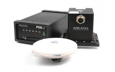
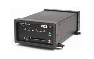
POS LV is a compact, fully integrated, turnkey position and orientation system, utilizing integrated inertial technology to generate stable, reliable and repeatable positioning solutions for land-based vehicle applications.

IMU: Inertial Measurement Unit generates a true representation of vehicle motion in all three axes, producing continuous, accurate position and orientation information
PCS: POS Computer System enables raw GPS data from as few as one satellite to be processed directly into the system, to compute accurate positional information in areas of intermittent, or no GPS reception ;
(DMI) Distance Measurement Instrument

The distance measurement instrument (DMI) is another essential piece of the POS LV hardware which outputs pulses representing fractional revolutions of the instrumented wheel. These pulses are converted by the POS LV into measurements of incremental distance travelled by the vehicle when no GPS is available. ;
BENEFITS
Generates continuous, accurate, position and orientation information under the most difficult GPS conditions ;
Produces precise, high-rate, low-latency, real-time data ;
Operates at normal highway traffic speeds for cost-effective data capture ;
Allows quick operational capability, with installation, calibration and training completed in as little as three days ;
Includes an automatic redundant data logging capability ;
Uses the latest survey-grade GPS technology for improved positioning performance ;
Requires less space in the survey vehicle, using a small, lightweight POS Computer System (PCS) .